Kod: 08842754
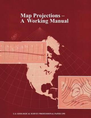
Map Projections
Autor John P Snyder
After decades of using only one map projection, the Polyconic, for its mapping program, the U.S. Geological Survey (USGS) now uses several of the more common projections for its published maps. For larger scale maps, including top ... więcej
- Język:
 Angielski
 - Oprawa: Miękka
- Liczba stron: 406
Wydawca: WWW.Militarybookshop.Co.UK, 2012
- Więcej informacji o książce

Zobacz książki o podobnej tematyce
-

Blackwell's Five-Minute Veterinary Consult
604.06 zł -

Dino Dana
81.11 zł -4 % -

Whole Library Handbook Pt. 4
236.82 zł -

Through It All, I Remain Optimistic
96.87 zł -

C Cause of the Universe Ultimate Cause UC
91.65 zł -

Feeding The Giant
50.79 zł -

In-Depth Poetic Scriptures
64.84 zł
Bon podarunkowy: Radość gwarantowana
- Podaruj bon o dowolnej wartości, a my się zajmiemy resztą.
- Bon podarunkowy dotyczy całej naszej oferty.
- Możesz wydrukować elektroniczny bon z e-maila a następnie przekazać go obdarowanemu.
- Ważność bonu wynosi 12 miesięcy od daty wystawienia.
Więcej informacji o Map Projections
Za ten zakup dostaniesz 148 punkty
 Opis
Opis
After decades of using only one map projection, the Polyconic, for its mapping program, the U.S. Geological Survey (USGS) now uses several of the more common projections for its published maps. For larger scale maps, including topographic quadrangles and the State Base Map Series, conformal projections such as the Transverse Mercator and the Lambert Conformal Conic are used. Equal-area and equidistant projections appear in the National Atlas. Other projections, such as the Miller Cylindrical and the Van der Grinten, are chosen occasionally for convenience, sometimes making use of existing base maps prepared by others. Some projections treat the Earth only as a sphere, others as either ellipsoid or sphere. The USGS has also conceived and designed several new projections, including the Space Oblique Mercator, the first map projection designed to permit mapping of the Earth continuously from a satellite with low distortion. The mapping of extraterrestrial bodies has resulted in the use of standard projections in completely new settings. Several other projections which have not been used by the USGS are frequently of interest to the cartographic public. With increased computerization, it is important to realize that rectangular coordinates for all these projections may be mathematically calculated with formulas which would have seemed too complicated in the past, but which now may be programmed routinely, especially if aided by numerical examples. A discussion of appearance, usage, and history is given together with both forward and inverse equations for each projection involved.
 Szczegóły książki
Kategoria Książki po angielsku Earth sciences, geography, environment, planning Earth sciences Geology & the lithosphere
252.88 zł
- Pełny tytuł: Map Projections
- Podtytuł: A Working Manual (U.S. Geological Survey Professional Paper 1395)
- Autor: John P Snyder
- Język:
 Angielski
 - Oprawa: Miękka
- Liczba stron: 406
- EAN: 9781782662228
- ISBN: 9781782662228
- ID: 08842754
- Wydawca: WWW.Militarybookshop.Co.UK
- Waga: 948 g
- Wymiary: 278 × 219 × 22 mm
- Data wydania: 31. October 2012
Ulubione w innej kategorii
-

Reading the Rocks
81.21 zł -5 % -

Nature and Properties of Soils, The, Global Edition
314.62 zł -

Past Time: Geology in European and American Art
190.24 zł -7 % -

S & S Guide to Rocks and Minerals
107.31 zł -11 % -

Structural Geology
288.12 zł -

Sea without Fish
168.15 zł -22 % -

Geological Field Techniques
373.85 zł -

Soil Science Simplified 6e
454.77 zł -

Lost World of Fossil Lake
178.29 zł -5 % -

Pleistocene Boundary and the Beginning of the Quaternary
404.48 zł -

Stable Isotope Geochemistry
475.96 zł -

H2O
51.69 zł -23 % -

Mycorrhizal Planet
138.53 zł -23 % -

Story of Earth
81.21 zł -11 % -

Geology For Dummies
105.20 zł -4 % -

True Truffle (Tuber spp.) in the World
1269.67 zł -

Annals of the Former World
121.27 zł -4 % -

Environmental Chemistry
662.09 zł -

Radon: A Tracer for Geological, Geophysical and Geochemical Studies
1288.44 zł -

The Geology of Kuwait
193.65 zł -

Medical Geology
331.57 zł -1 % -

Anthropocene: A Very Short Introduction
43.26 zł -15 % -

Ice Age
392.83 zł -

Brief History of Geology
145.06 zł -5 % -

Rocks: A Very Short Introduction
57.31 zł -5 % -

Glaciation: A Very Short Introduction
42.56 zł -23 % -

Geology: A Very Short Introduction
42.56 zł -23 % -

Making of Europe
162.83 zł -7 % -

Mineral Resources, Economics and the Environment
349.66 zł -
Timefulness
202.18 zł -

Historical Geology
351.27 zł -22 % -
Global Geomorphology
371.04 zł -

Principles of Geology, Volume 1
137.23 zł -31 % -
Plate Tectonics: A Very Short Introduction
57.31 zł -5 % -

Igneous and Metamorphic Petrology 2e
627.35 zł -

Landscapes and Geomorphology: A Very Short Introduction
55.41 zł -5 % -

Ore Deposit Geology
329.38 zł -

Soil and Environmental Chemistry
525.75 zł -

Tectonic Geomorphology 2e
498.85 zł -

Fossils: A Very Short Introduction
55.21 zł -5 % -

Earth on Show
251.98 zł -

Quaternary Paleoenvironments - Submerged Landscapes of the European Continental Shelf.
580.87 zł -

Last Giant of Beringia
116.85 zł -

Pleistocene
1118.17 zł -
Earth: An Introduction to Physical Geology, Global Edition
378.07 zł -

White River Badlands
184.92 zł -5 % -

Principles of Geology, Volume 2
313.22 zł -

Principles of Geology, Volume 3
313.22 zł -
Geomorphology
460.19 zł
zadowolonych klientów
Od roku 2008 obsłużyliśmy wielu miłośników książek, ale dla nas każdy był tym wyjątkowym.
Copyright! ©2008-24 libristo.pl Wszelkie prawa zastrzeżonePrywatnieCookies


 21 milionów książek
 Dostawa 10.99 zł
 (32) 444 93 66 (8-15.30h)