Kod: 05037128
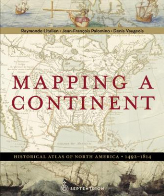
Mapping a Continent
Autor Raymonde Litalien, Jean-Francois Palomino, Denis Vaugeois
In March 1493, Christopher Columbus returned from a long voyage to the west, convinced he had reached India. In truth, an immense continent, then absent from any map, had blocked his path. A formidable barrier separating Europe fr ... więcej
- Język:
 Angielski
 - Oprawa: Twarda
- Liczba stron: 300
Wydawca: Editions du Septentrion,Canada, 2007
- Więcej informacji o książce

405.36 zł
Zwykle: 405.36 zł
Oszczędzasz 0.01 zł
Dostępność:
50 % szansa Otrzymaliśmy informację, że książka może być ponownie dostępna. Na podstawie państwa zamówienia, postaramy się książkę sprowadzić w terminie do 6 tygodni. Gwarancja pełnego zwrotu pieniędzy, jeśli książka nie zostanie zabezpieczona.
Przeszukamy cały świat
Zobacz książki o podobnej tematyce
Bon podarunkowy: Radość gwarantowana
- Podaruj bon o dowolnej wartości, a my się zajmiemy resztą.
- Bon podarunkowy dotyczy całej naszej oferty.
- Możesz wydrukować elektroniczny bon z e-maila a następnie przekazać go obdarowanemu.
- Ważność bonu wynosi 12 miesięcy od daty wystawienia.
Powiadomienie o dostępności
Wpisz swój adres e-mail, aby otrzymać od nas powiadomienie,
gdy książka będzie dostępna. Proste, prawda?
Więcej informacji o Mapping a Continent
Za ten zakup dostaniesz 237 punkty
 Opis
Opis
In March 1493, Christopher Columbus returned from a long voyage to the west, convinced he had reached India. In truth, an immense continent, then absent from any map, had blocked his path. A formidable barrier separating Europe from Asia, North America became a coveted land, attracting sailors, missionaries, trappers, soldiers and scientists. Seeking not only the Vermilion Sea but also fish, beavers, and precious metals, they crossed rivers and trekked through portages, forests, and mountains. With the help of "Indians" they unlocked the secrets of this terra incognita. Art, scientific papers, and maps provide essential witness to this quest for knowledge that allowed Columbus, Auchagac, Champlain, Franquelin, Thomspon, Mackenzie, and Lewis and Clark to take the measure of America. For three centuries, motivated by the goal of finding a nautical route to the Pacific Ocean and from there the Orient, European explorers surveyed and mapped the large territory, exploring every body of water, from the tiniest bays to the greatest rivers, and pushing deeper into the interior. Three hundred years almost to the day after Columbus' first voyage, Alexander Mackenzie reached the Pacific Ocean "from Canada, by land, 22 July 1793." In 1805, spurred on by Jefferson, the Lewis and Clark expedition crossed the continent from the Missouri-Mississippi delta to where the Columbia River flows into the Pacific Ocean. The continent's measure had been taken.
 Szczegóły książki
Kategoria Książki po angielsku Humanities History History: specific events & topics
405.36 zł
- Pełny tytuł: Mapping a Continent
- Podtytuł: Historical Atlas of North America, 1492-1814
- Autor: Raymonde Litalien, Jean-Francois Palomino, Denis Vaugeois
- Język:
 Angielski
 - Oprawa: Twarda
- Liczba stron: 300
- EAN: 9782894485279
- ID: 05037128
- Wydawca: Editions du Septentrion,Canada
- Waga: 2055 g
- Wymiary: 334 × 273 × 23 mm
- Data wydania: 25. October 2007
Ulubione w innej kategorii
-

Man's Search for Meaning
31.06 zł -3 % -

Women, Race & Class
46.80 zł -14 % -

Pianist
47.60 zł -22 % -

Out Of Place
51.61 zł -23 % -

Little History of Economics
65.25 zł -4 % -

Laughter in Ancient Rome
85.59 zł -11 % -

Civilization and Capitalism, 15th-18th Century
279.16 zł -

Armies of Medieval Burgundy 1364-1477
67.25 zł -15 % -

Night
42.49 zł -23 % -

Society of the Spectacle
49.51 zł -

Imperialism: The Highest Stage of Capitalism
28.16 zł -22 % -

Man's Search For Meaning
70.06 zł -23 % -

Homo Deus
50.21 zł -26 % -

Ordinary Men
52.11 zł -15 % -

Black Earth
60.94 zł -15 % -

The Complete MAUS
78.58 zł -14 % -

The Rape of Nanking
76.87 zł -14 % -

Madness and Civilization
81.08 zł -11 % -

Conquerors
52.11 zł -15 % -

Stoned
47.10 zł -23 % -

Twelve Years a Slave
15.23 zł -23 % -

At Home
51.61 zł -23 % -

Origins of Museums
254.30 zł -15 % -

Measure of a Man
44.60 zł -26 % -

Delirious New York
144.84 zł -5 % -

Eichmann in Jerusalem
52.11 zł -15 % -

Mein Kampf - The Ford Translation
171.70 zł -

Bloodlands
60.94 zł -15 % -

Guns, Germs and Steel
60.94 zł -15 % -

Cold War Submarines
177.81 zł -5 % -

Fall of Public Man
70.06 zł -23 % -

Che Guevara
92.71 zł -23 % -

Dancing In The Streets
51.61 zł -23 % -

Fix the Pumps
73.06 zł -5 % -

Blue
158.67 zł -5 % -

Revolutionary Yiddishland
57.23 zł -14 % -

Commandant Of Auschwitz
51.61 zł -23 % -

Jewish State
49.21 zł -4 % -

Eichmann in Jerusalem
77.17 zł -5 % -

Reflections on the Revolution in France
42.49 zł -23 % -

Wall Street and the Bolshevik Revolution
60.84 zł -23 % -

Corgi Toys
73.06 zł -5 % -

Night
47.10 zł -23 % -

Wreck of the Titan
72.06 zł -

McMafia
51.61 zł -23 % -

Intimate History of Humanity
60.84 zł -23 % -

Feminism: A Very Short Introduction
42.49 zł -23 % -

White Gold
60.84 zł -23 % -

Twelve Who Ruled
108.85 zł -5 %
zadowolonych klientów
Od roku 2008 obsłużyliśmy wielu miłośników książek, ale dla nas każdy był tym wyjątkowym.
Copyright! ©2008-24 libristo.pl Wszelkie prawa zastrzeżonePrywatnieCookies


 21 milionów książek
 Dostawa 10.99 zł
 (32) 444 93 66 (8-15.30h)