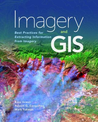
Kod: 14224732
Imagery and GIS
Autor Kass Green, Russell G. Congalton, Mark Tukman
Today, most maps include imagery in the form of aerial photos, satellite images, thermal images, digital elevation models, and scanned maps. Imagery and GIS: Best Practices for Extracting Information from Imagery shows how imagery ... więcej
- Język:
 Angielski
 - Oprawa: Miękka
- Liczba stron: 418
Wydawca: ESRI Press, 2017
- Więcej informacji o książce

483.24 zł
Zwykle: 508.71 zł
Oszczędzasz 25.47 zł

Dostępna u dostawcy
Wysyłamy za 14 - 18 dni
Zobacz książki o podobnej tematyce
-

Overcoming Underearning
92.91 zł -

Thematic Mapping
292.09 zł -5 % -

Our Babies, Ourselves
84.19 zł -
GIS Tutorial for ArcGIS Desktop 10.8
513.11 zł -
GIS for Science
196.46 zł -5 % -

Reconstruction and Analysis of 3D Scenes
827.66 zł -

LiDAR Remote Sensing and Applications
519.13 zł
Bon podarunkowy: Radość gwarantowana
- Podaruj bon o dowolnej wartości, a my się zajmiemy resztą.
- Bon podarunkowy dotyczy całej naszej oferty.
- Możesz wydrukować elektroniczny bon z e-maila a następnie przekazać go obdarowanemu.
- Ważność bonu wynosi 12 miesięcy od daty wystawienia.
Więcej informacji o Imagery and GIS
Za ten zakup dostaniesz 283 punkty
 Opis
Opis
Today, most maps include imagery in the form of aerial photos, satellite images, thermal images, digital elevation models, and scanned maps. Imagery and GIS: Best Practices for Extracting Information from Imagery shows how imagery can be integrated successfully into GIS maps and analysis.
 Szczegóły książki
Kategoria Książki po angielsku Earth sciences, geography, environment, planning Geography Geographical information systems (GIS) & remote sensing
483.24 zł
- Pełny tytuł: Imagery and GIS
- Podtytuł: Best Practices for Extracting Information from Imagery
- Autor: Kass Green, Russell G. Congalton, Mark Tukman
- Język:
 Angielski
 - Oprawa: Miękka
- Liczba stron: 418
- EAN: 9781589484542
- ISBN: 1589484541
- ID: 14224732
- Wydawca: ESRI Press
- Waga: 1178 g
- Wymiary: 254 × 203 × 30 mm
- Data wydania: 30. November 2017
Ulubione w innej kategorii
-

Designing Better Maps
292.09 zł -5 % -

Cartography.
284.27 zł -5 % -

Mastering Geospatial Analysis with Python
261.81 zł -

Semiology of Graphics
523.04 zł -4 % -

Geographic Information Science and Systems 4e
1049.99 zł -
GIS for Science
196.46 zł -5 % -

Geocaching
82.19 zł -4 % -

Introduction to Geographical Information Systems, An
358.85 zł -

Connections and Content
196.46 zł -5 % -

Focus on Geodatabases in ArcGIS Pro
292.29 zł -4 % -

Framework for Geodesign
387.71 zł -4 % -
Esri Guide to GIS Analysis, Volume 3
220.52 zł -5 % -

Springer Handbook of Geographic Information
1772.12 zł -

Geoinformatics
155.06 zł -

Mastering ArcGIS Server Development with JavaScript
234.05 zł -

GIS For Dummies
168.39 zł -

ArcGIS Book
101.13 zł -4 % -

Python For ArcGIS
612.25 zł -

Spring Boot Messaging
243.07 zł -
GNSS - Global Navigation Satellite Systems
914.77 zł -

GIS in Land and Property Management
1071.95 zł -
Spatial Statistics and Geostatistics
356.34 zł -

Programming GPS and OpenStreetMap Applications with Java
358.54 zł -

European Landscape Dynamics
1012.51 zł -

Introduction to GIS Programming and Fundamentals with Python and ArcGIS (R)
612.25 zł -

Satellite Interferometry Data Interpretation and Exploitation
740.16 zł -9 % -
Error Propagation in Environmental Modelling with GIS
662.77 zł -

QGIS Python Programming Cookbook -
261.72 zł -

Learning ArcGIS Pro
261.72 zł -

GPS For Dummies 2e
113.06 zł -5 % -

Mastering QGIS -
289.58 zł -

Introducing Geographic Information Systems with ArcGIS - A Workbook Approach to Learning GIS, Third Edition
572.25 zł -

Physical Principles of Remote Sensing
829.87 zł -
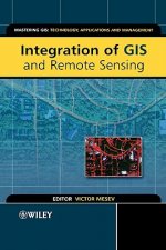
Integration of GIS and Remote Sensing
1152.24 zł -

Energy of Nations
223.72 zł -

New Developments and Environmental Applications of Drones
931.51 zł -
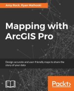
Mapping with ArcGIS Pro
234.05 zł -

GIS and Spatial Analysis for the Social Sciences
495.37 zł -

Satellite Altimetry Over Oceans and Land Surfaces
1071.95 zł -

Learning QGIS 2.0
131.90 zł -

Open Source GIS
864.35 zł -

ArcGIS Pro and ArcGIS Online Applications in Water and Environmental Sciences
405.36 zł -

Recent Advances in Remote Sensing for Crop Growth Monitoring
433.32 zł -1 % -

Spatial Conservation Prioritization
959.18 zł -

Artificial Intelligence in Geography
1532.65 zł -
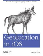
Geolocation in iOS
103.64 zł -

Spatial Data Mining
461.09 zł -

Thermal Infrared Remote Sensing
909.76 zł -

Advances in Location-Based Services
864.35 zł
zadowolonych klientów
Od roku 2008 obsłużyliśmy wielu miłośników książek, ale dla nas każdy był tym wyjątkowym.
Copyright! ©2008-24 libristo.pl Wszelkie prawa zastrzeżonePrywatnieCookies


 21 milionów książek
 Dostawa 10.99 zł
 (32) 444 93 66 (8-15.30h)