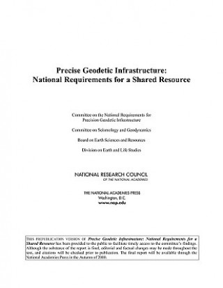
Kod: 04579135
Precise Geodetic Infrastructure
Autor Committee on the National Requirements for Precision Geodetic Infrastructure, Committee on Seismology and Geodynamics, Board on Earth Sciences & Resou
Geodesy is the science of accurately measuring and understanding three fundamental properties of Earth: its geometric shape, its orientation in space, and its gravity field, as well as the changes of these properties with time. Ov ... więcej
- Język:
 Angielski
 - Oprawa: Miękka
- Liczba stron: 156
Wydawca: National Academies Press, 2010
- Więcej informacji o książce

378.03 zł
Dostępność:
50 % szansa Otrzymaliśmy informację, że książka może być ponownie dostępna. Na podstawie państwa zamówienia, postaramy się książkę sprowadzić w terminie do 6 tygodni. Gwarancja pełnego zwrotu pieniędzy, jeśli książka nie zostanie zabezpieczona.
Przeszukamy cały świat
Zobacz książki o podobnej tematyce
-

Cabin Porn
55.24 zł -3 %
Bon podarunkowy: Radość gwarantowana
- Podaruj bon o dowolnej wartości, a my się zajmiemy resztą.
- Bon podarunkowy dotyczy całej naszej oferty.
- Możesz wydrukować elektroniczny bon z e-maila a następnie przekazać go obdarowanemu.
- Ważność bonu wynosi 12 miesięcy od daty wystawienia.
Powiadomienie o dostępności
Wpisz swój adres e-mail, aby otrzymać od nas powiadomienie,
gdy książka będzie dostępna. Proste, prawda?
Więcej informacji o Precise Geodetic Infrastructure
Za ten zakup dostaniesz 221 punkty
 Opis
Opis
Geodesy is the science of accurately measuring and understanding three fundamental properties of Earth: its geometric shape, its orientation in space, and its gravity field, as well as the changes of these properties with time. Over the past half century, the United States, in cooperation with international partners, has led the development of geodetic techniques and instrumentation. Geodetic observing systems provide a significant benefit to society in a wide array of military, research, civil, and commercial areas, including sea level change monitoring, autonomous navigation, tighter low flying routes for strategic aircraft, precision agriculture, civil surveying, earthquake monitoring, forest structural mapping and biomass estimation, and improved floodplain mapping. Recognizing the growing reliance of a wide range of scientific and societal endeavors on infrastructure for precise geodesy, and recognizing geodetic infrastructure as a shared national resource, this book provides an independent assessment of the benefits provided by geodetic observations and networks, as well as a plan for the future development and support of the infrastructure needed to meet the demand for increasingly greater precision. Precise Geodetic Infrastructure makes a series of focused recommendations for upgrading and improving specific elements of the infrastructure, for enhancing the role of the United States in international geodetic services, for evaluating the requirements for a geodetic workforce for the coming decades, and for providing national coordination and advocacy for the various agencies and organizations that contribute to the geodetic infrastructure.
 Szczegóły książki
Kategoria Książki po angielsku Earth sciences, geography, environment, planning Geography Geodesy & surveying for maps & charts
378.03 zł
- Pełny tytuł: Precise Geodetic Infrastructure
- Autor: Committee on the National Requirements for Precision Geodetic Infrastructure, Committee on Seismology and Geodynamics, Board on Earth Sciences & Resou
- Język:
 Angielski
 - Oprawa: Miękka
- Liczba stron: 156
- EAN: 9780309158114
- ISBN: 0309158117
- ID: 04579135
- Wydawca: National Academies Press
- Waga: 444 g
- Wymiary: 180 × 256 × 12 mm
- Data wydania: 25. October 2010
Ulubione w innej kategorii
-

Theory of Satellite Geodesy
57.15 zł -5 % -

Conformal Mapping
120.54 zł -4 % -

Introduction to Geodesy: The History and Concepts of Modern Geodesy
643.35 zł -

John Norden's The Surveyor's Dialogue (1618)
866.28 zł -

History of Spaces
461.92 zł -
Applications of Geodesy to Engineering
563.08 zł -
Recent Geodetic and Gravimetric Research in Latin America
563.08 zł -
Gravity, Geoid and Space Missions
1118.94 zł -

Theory of Satellite Geodesy and Gravity Field Determination
285 zł -

History of Spaces
1118.94 zł -

Ecological Classification of Saskatchewn's Mid-Boreal Ecoregions Using Resource Maps and Aerial Photographs
99.45 zł -9 % -

Interdisciplinary Role of Space Geodesy
285 zł -

VI Hotine-Marussi Symposium on Theoretical and Computational Geodesy
1118.94 zł -

History of the International Polar Years (IPYs)
1118.94 zł -

Sensing and Monitoring Technologies for Mines and Hazardous Areas
826.59 zł -

Surveying
231.25 zł -

Geodetic Theory Today
563.08 zł -
Geodesy in the Year 2000
284.40 zł -

Mathematical Foundation of Geodesy
975.38 zł -

Vrancea Earthquakes: Tectonics, Hazard and Risk Mitigation
866.28 zł -

Full Meridian of Glory
132.20 zł -5 % -

Earth Sciences in the Age of the Satellite
563.08 zł -

Precision Surveying - The Principles and Geomatics Practice
891.99 zł -

Aerial Surveying by Rapid Methods
223.12 zł -

Advances in Positioning and Reference Frames
1118.94 zł -

IV Hotine-Marussi Symposium on Mathematical Geodesy
1118.94 zł -

Applied Geodesy
285 zł -

Vistas for Geodesy in the New Millennium
1461.41 zł -

Introduction to Regional Surveying
228.24 zł -

V Hotine-Marussi Symposium on Mathematical Geodesy
975.38 zł -

Window on the Future of Geodesy
1461.41 zł -

Satellite Geodesy
669.77 zł -

Geoid Determination
1695.89 zł
zadowolonych klientów
Od roku 2008 obsłużyliśmy wielu miłośników książek, ale dla nas każdy był tym wyjątkowym.
Copyright! ©2008-24 libristo.pl Wszelkie prawa zastrzeżonePrywatnieCookies


 21 milionów książek
 Dostawa 10.99 zł
 (32) 444 93 66 (8-15.30h)