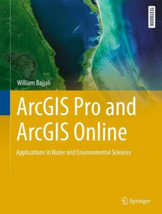
Kod: 43829918
ArcGIS Pro and ArcGIS Online Applications in Water and Environmental Sciences
Autor William Bajjali
This textbook teaches applied GIS techniques to undergraduate and graduate students in geology, hydrology, ecology, and environmental sciences. The book is written as a step-by-step tutorial, and through sixteen chapters, it takes ... więcej
- Język:
 Angielski
 - Oprawa: Twarda
- ISBN-13: 9783031422263
Wydawca: Springer, Berlin, 2023
- Więcej informacji o książce

407.38 zł

Dostępna u dostawcy w małych ilościach
Wysyłamy za 3 - 5 dni
Potrzebujesz więcej egzemplarzy?Jeżeli jesteś zainteresowany zakupem większej ilości egzemplarzy, skontaktuj się z nami, aby sprawdzić ich dostępność.
Dodaj do schowka
Zobacz książki o podobnej tematyce
-

The In-Between: Unforgettable Encounters During Life's Final Moments
113.62 zł -5 % -

With a Little Luck
89.75 zł -4 % -

Kissinger
75.74 zł -26 % -

Getting to Know Arcgis Pro 3.2
485.65 zł -5 % -

Python for ArcGIS Pro
326.48 zł
Bon podarunkowy: Radość gwarantowana
- Podaruj bon o dowolnej wartości, a my się zajmiemy resztą.
- Bon podarunkowy dotyczy całej naszej oferty.
- Możesz wydrukować elektroniczny bon z e-maila a następnie przekazać go obdarowanemu.
- Ważność bonu wynosi 12 miesięcy od daty wystawienia.
Więcej informacji o ArcGIS Pro and ArcGIS Online Applications in Water and Environmental Sciences
Za ten zakup dostaniesz 237 punkty
 Opis
Opis
This textbook teaches applied GIS techniques to undergraduate and graduate students in geology, hydrology, ecology, and environmental sciences. The book is written as a step-by-step tutorial, and through sixteen chapters, it takes students from the very basics of GIS techniques through real-life examples from the fields of geology and water resources. The textbook is structured around Esri's ArcGIS Pro and its diverse tools that cover spatial, geostatistical, network, and 3-D analysis. It also coversArcGIS Online and working with web apps such as Web Map, StoryMaps, and Survey123.GIS applications continues to be fastest growing branch in all disciplines worldwide especially in water and environmental related problems. There is ongoing demand for experts in GIS using spatial analysis to be applied in the field of environmental science; this textbook includes much of what users require to understand to become an effective mapper and spatial analyst in the field of environment, geosciences, and water resources. It provides professionals and students with many opportunities to acquire, visualize, and analyse data in the latest in state of art methodology. Each chapter features exercises and supplementary materials that can be downloaded from SpringerLink as well as links for further learning.
 Szczegóły książki
Kategoria Książki po angielsku Earth sciences, geography, environment, planning Geography Geographical information systems (GIS) & remote sensing
407.38 zł
- Pełny tytuł: ArcGIS Pro and ArcGIS Online Applications in Water and Environmental Sciences
- Autor: William Bajjali
- Język:
 Angielski
 - Oprawa: Twarda
- EAN: 9783031422263
- ID: 43829918
- Wydawca: Springer, Berlin
- Wymiary: 279 × 210 mm
- Data wydania: 19. October 2023
Ulubione w innej kategorii
-

Designing Better Maps
293.54 zł -5 % -

Cartography.
285.68 zł -5 % -

Mastering Geospatial Analysis with Python
263.12 zł -

Semiology of Graphics
525.64 zł -4 % -

Geographic Information Science and Systems 4e
1055.22 zł -
GIS for Science
197.44 zł -5 % -

Geocaching
82.60 zł -4 % -

Introduction to Geographical Information Systems, An
360.63 zł -

Connections and Content
221.92 zł -

Focus on Geodatabases in ArcGIS Pro
293.74 zł -4 % -

Framework for Geodesign
389.64 zł -4 % -
Esri Guide to GIS Analysis, Volume 3
221.61 zł -5 % -

Springer Handbook of Geographic Information
1780.94 zł -

Reconstruction and Analysis of 3D Scenes
831.79 zł -

Geoinformatics
155.83 zł -

Mastering ArcGIS Server Development with JavaScript
235.21 zł -

LiDAR Remote Sensing and Applications
521.71 zł -

GIS For Dummies
169.23 zł -
ArcGIS Book
101.63 zł -4 % -
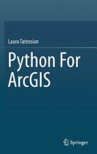
Python For ArcGIS
615.30 zł -

Spring Boot Messaging
244.28 zł -
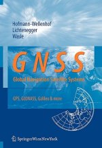
GNSS - Global Navigation Satellite Systems
919.33 zł -

GIS in Land and Property Management
1077.28 zł -

Spatial Statistics and Geostatistics
358.12 zł -

Programming GPS and OpenStreetMap Applications with Java
360.33 zł -

European Landscape Dynamics
1017.55 zł -

Introduction to GIS Programming and Fundamentals with Python and ArcGIS (R)
615.30 zł -

Satellite Interferometry Data Interpretation and Exploitation
743.84 zł -9 % -

Error Propagation in Environmental Modelling with GIS
666.07 zł -

QGIS Python Programming Cookbook -
263.02 zł -

Learning ArcGIS Pro
263.02 zł -

GPS For Dummies 2e
113.62 zł -5 % -

Mastering QGIS -
291.02 zł -

Introducing Geographic Information Systems with ArcGIS - A Workbook Approach to Learning GIS, Third Edition
515.37 zł -

Integration of GIS and Remote Sensing
1157.98 zł -

Energy of Nations
224.84 zł -

Physical Principles of Remote Sensing
834 zł -

New Developments and Environmental Applications of Drones
954.68 zł -

Mapping with ArcGIS Pro
235.21 zł -

GIS and Spatial Analysis for the Social Sciences
497.84 zł -

Satellite Altimetry Over Oceans and Land Surfaces
1077.28 zł -

Learning QGIS 2.0
132.56 zł -

Open Source GIS
868.66 zł -

Recent Advances in Remote Sensing for Crop Growth Monitoring
435.48 zł -1 % -

Spatial Conservation Prioritization
963.95 zł -

Artificial Intelligence in Geography
1540.28 zł -
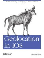
Geolocation in iOS
104.15 zł -

Spatial Data Mining
463.39 zł -

Thermal Infrared Remote Sensing
914.29 zł
zadowolonych klientów
Od roku 2008 obsłużyliśmy wielu miłośników książek, ale dla nas każdy był tym wyjątkowym.
Copyright! ©2008-24 libristo.pl Wszelkie prawa zastrzeżonePrywatnieCookies


 21 milionów książek
 Dostawa 10.99 zł
 (32) 444 93 66 (8-15.30h)