Kod: 38573177
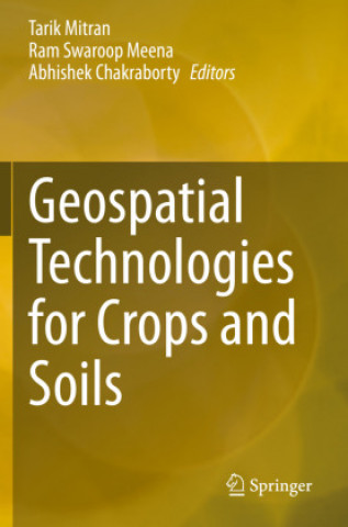
Geospatial Technologies for Crops and Soils
Autor Tarik Mitran, Ram Swaroop Meena, Abhishek Chakraborty
The sustainable development of the agriculture sector is the only option to meet the demands of increased and economically viable production in a changing climate. This means there is a need to introduce the latest technologies to ... więcej
- Język:
 Angielski
 - Oprawa: Miękka
- Liczba stron: 521
Wydawca: Springer, Berlin, 2021
- Więcej informacji o książce

Zobacz książki o podobnej tematyce
-

Dune
34.84 zł -33 % -

Haunting Adeline
125.81 zł -1 % -

Berserk Deluxe Volume 2
212.65 zł -1 % -

White Nights
15.30 zł -23 % -

Powerless
48.75 zł -11 % -

Atomic Habits
59.22 zł -26 % -

Dune Messiah
46.33 zł -3 % -

Berserk Deluxe Volume 3
218.19 zł -3 % -

One Day
32.63 zł -36 % -

Berserk Deluxe Volume 1
211.84 zł -2 % -

Iron Flame
61.14 zł -28 % -

Surrounded by Idiots
36.76 zł -28 % -

Harry Potter and the Prisoner of Azkaban (Minalima Edition)
170.44 zł -2 % -

Gravity Falls Journal 3
89.45 zł -

Heaven Official's Blessing: Tian Guan Ci Fu (Novel) Vol. 1
88.94 zł -1 % -

The Creative Act
100.22 zł -15 % -

Dune
47.34 zł -23 % -

Hunting Adeline
126.52 zł -4 % -

A Little Life
47.04 zł -14 % -

Children of Dune
46.73 zł -2 % -

Heaven Official's Blessing: Tian Guan Ci Fu (Novel) Vol. 2
77.76 zł -14 %
Podaruj tę książkę jeszcze dziś
- Zamów książkę i wybierz "Wyślij jako prezent".
- Natychmiast wyślemy Ci bon podarunkowy, który możesz przekazać adresatowi prezentu.
- Książka zostanie wysłana do adresata, a Ty o nic nie musisz się martwić.
Więcej informacji o Geospatial Technologies for Crops and Soils
Za ten zakup dostaniesz 646 punkty
 Opis
Opis
The sustainable development of the agriculture sector is the only option to meet the demands of increased and economically viable production in a changing climate. This means there is a need to introduce the latest technologies to enhance production, and also help policymakers make decisions for the future. Geospatial technologies & tools, such as remote sensing, geographical information systems (GIS), global positioning systems (GPS), and mobile & web applications, provide unique capabilities to analyze multi-scale, multi-temporal datasets, and support decision-making in sustainable agriculture development and natural resources management. Further, the availability of reliable and timely geospatial information on natural resources and environmental conditions is essential for sustainable agricultural development and food security. Since remote sensing solutions are fast, non-destructive and have large spatial coverage, they can play a significant role in the identification, inventory, and mapping of land resources. Over the past four decades, remote sensing has proved to be a cost-effective and powerful tool to assess crop and soil properties in varying spatial and temporal scales using both visual and digital techniques. Satellite remote sensing coupled with GIS & mobile-app based positional information has emerged as an efficient tool for optimizing input resources, and minimizing cost of production and risk of biotic/ abiotic factors nature to promote sustainable agriculture. This book comprehensively documents the applications of space-based technologies for crop and soil assessments for the sustainable development of agriculture.
 Szczegóły książki
Kategoria Książki po angielsku Earth sciences, geography, environment, planning Geography Biogeography
1109.82 zł
- Pełny tytuł: Geospatial Technologies for Crops and Soils
- Autor: Tarik Mitran, Ram Swaroop Meena, Abhishek Chakraborty
- Język:
 Angielski
 - Oprawa: Miękka
- Liczba stron: 521
- EAN: 9789811568664
- ID: 38573177
- Wydawca: Springer, Berlin
- Waga: 961 g
- Wymiary: 24 × 155 × 235 mm
- Rok wydania: 2021
zadowolonych klientów
Od roku 2008 obsłużyliśmy wielu miłośników książek, ale dla nas każdy był tym wyjątkowym.
Copyright! ©2008-24 libristo.pl Wszelkie prawa zastrzeżonePrywatnieCookies


 21 milionów książek
 Dostawa 10.99 zł
 (32) 444 93 66 (8-15.30h)