Kod: 04709276
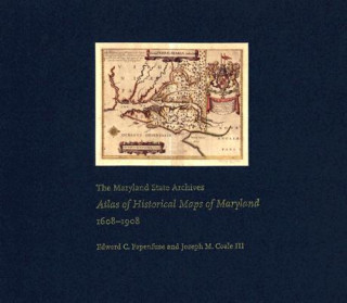
Maryland State Archives Atlas of Historical Maps of Maryland, 1608-1908
Autor Edward C. Papenfuse, Joseph M. Coale, Joseph M. Coale III
Maryland presents cartographers with a formidable test of their skills: unusual natural boundaries, border disputes, and in 1790 the gift of sixty-seven square miles for the creation of the District of Columbia have given the stat ... więcej
- Język:
 Angielski
 - Oprawa: Twarda
- Liczba stron: 240
Wydawca: Johns Hopkins University Press, 2003
- Więcej informacji o książce

488.87 zł
Dostępność:
50 % szansa Otrzymaliśmy informację, że książka może być ponownie dostępna. Na podstawie państwa zamówienia, postaramy się książkę sprowadzić w terminie do 6 tygodni. Gwarancja pełnego zwrotu pieniędzy, jeśli książka nie zostanie zabezpieczona.
Przeszukamy cały świat
Zobacz książki o podobnej tematyce
-

Charlie, Meg and Me
47.34 zł -23 % -

Credo
74.64 zł -

Seal Surfer
57.51 zł -5 %
Bon podarunkowy: Radość gwarantowana
- Podaruj bon o dowolnej wartości, a my się zajmiemy resztą.
- Bon podarunkowy dotyczy całej naszej oferty.
- Możesz wydrukować elektroniczny bon z e-maila a następnie przekazać go obdarowanemu.
- Ważność bonu wynosi 12 miesięcy od daty wystawienia.
Powiadomienie o dostępności
Wpisz swój adres e-mail, aby otrzymać od nas powiadomienie,
gdy książka będzie dostępna. Proste, prawda?
Więcej informacji o Maryland State Archives Atlas of Historical Maps of Maryland, 1608-1908
Za ten zakup dostaniesz 285 punkty
 Opis
Opis
Maryland presents cartographers with a formidable test of their skills: unusual natural boundaries, border disputes, and in 1790 the gift of sixty-seven square miles for the creation of the District of Columbia have given the state a distinctively irregular configuration. Since the early seventeenth century, generations of mapmakers have met this challenge with artistic imagination and a variety of cartographical techniques. In The Maryland State Archives Atlas of Historical Maps of Maryland, 1608-1908, Edward C. Papenfuse and Joseph M. Coale III bring together in one volume the results of these remarkable efforts, from Captain John Smith's 1608 detailed sketch of the region to the map resulting from the Supreme Court's determination of the state's western border in 1908. Utilizing the latest digital imaging and printing technology, the Atlas contains stunning, full-color reproductions of more than 250 of the most significant historical maps from state and federal archives. This handsome and informative collection-a thoroughly updated and greatly expanded version of the authors' landmark book, The Hammond-Harwood House Atlas of Historical Maps of Maryland (1982)-provides an in-depth history of mapmaking in Maryland and charts the state's early settlement patterns.
 Szczegóły książki
Kategoria Książki po angielsku Humanities History History: specific events & topics
488.87 zł
- Pełny tytuł: Maryland State Archives Atlas of Historical Maps of Maryland, 1608-1908
- Autor: Edward C. Papenfuse, Joseph M. Coale, Joseph M. Coale III
- Język:
 Angielski
 - Oprawa: Twarda
- Liczba stron: 240
- EAN: 9780801872358
- ID: 04709276
- Wydawca: Johns Hopkins University Press
- Waga: 2428 g
- Wymiary: 369 × 318 × 22 mm
- Data wydania: 25. April 2003
Ulubione w innej kategorii
-

Man's Search for Meaning
31.22 zł -3 % -

Women, Race & Class
47.04 zł -14 % -

Pianist
47.84 zł -22 % -

Out Of Place
51.87 zł -23 % -

Little History of Economics
65.77 zł -4 % -

Laughter in Ancient Rome
86.02 zł -11 % -

Civilization and Capitalism, 15th-18th Century
280.55 zł -

Armies of Medieval Burgundy 1364-1477
67.58 zł -15 % -

Night
42.70 zł -23 % -

Society of the Spectacle
49.75 zł -

Imperialism: The Highest Stage of Capitalism
33.64 zł -23 % -

Man's Search For Meaning
70.41 zł -23 % -

Homo Deus
50.46 zł -26 % -

Ordinary Men
52.37 zł -15 % -

Black Earth
61.24 zł -15 % -

The Complete MAUS
78.97 zł -14 % -

The Rape of Nanking
77.26 zł -14 % -

Madness and Civilization
79.78 zł -12 % -

Conquerors
52.37 zł -15 % -

Stoned
47.34 zł -23 % -

Twelve Years a Slave
15.30 zł -23 % -

At Home
51.87 zł -23 % -

Origins of Museums
255.56 zł -15 % -

Measure of a Man
44.82 zł -26 % -

Delirious New York
145.56 zł -5 % -

Eichmann in Jerusalem
52.37 zł -15 % -

Mein Kampf - The Ford Translation
172.55 zł -

Bloodlands
61.24 zł -15 % -

Guns, Germs and Steel
61.24 zł -15 % -

Cold War Submarines
185.35 zł -5 % -

Fall of Public Man
70.41 zł -23 % -

Che Guevara
93.17 zł -23 % -

Dancing In The Streets
51.87 zł -23 % -

Fix the Pumps
73.43 zł -5 % -

Blue
165.50 zł -5 % -

Revolutionary Yiddishland
57.51 zł -14 % -

Commandant Of Auschwitz
51.87 zł -23 % -

Jewish State
49.45 zł -4 % -

Eichmann in Jerusalem
77.56 zł -5 % -

Reflections on the Revolution in France
42.70 zł -23 % -

Wall Street and the Bolshevik Revolution
61.14 zł -23 % -

Corgi Toys
73.43 zł -5 % -

Night
47.34 zł -23 % -

Wreck of the Titan
65.57 zł -4 % -

McMafia
51.87 zł -23 % -

Intimate History of Humanity
61.14 zł -23 % -

Feminism: A Very Short Introduction
42.70 zł -23 % -

White Gold
61.14 zł -23 % -

Twelve Who Ruled
113.42 zł -5 %
zadowolonych klientów
Od roku 2008 obsłużyliśmy wielu miłośników książek, ale dla nas każdy był tym wyjątkowym.
Copyright! ©2008-24 libristo.pl Wszelkie prawa zastrzeżonePrywatnieCookies


 21 milionów książek
 Dostawa 10.99 zł
 (32) 444 93 66 (8-15.30h)