Kod: 04353669
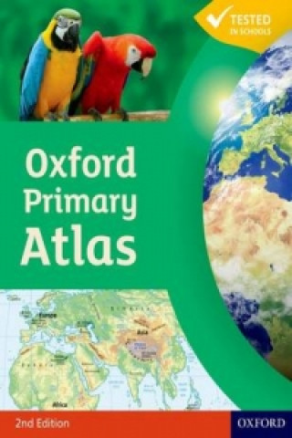
Oxford Primary Atlas
Autor Patrick Wiegland
The Oxford Primary Atlas is a clear, bright and informative atlas for all 7-11 year olds. This new edition includes up-to-date country data and easy-to-read colourful mapping, presented in an accessible visual layout based on rese ... więcej
- Język:
 Angielski
 - Oprawa: Twarda
- Liczba stron: 88
Wydawca: Oxford University Press, 2011
- Więcej informacji o książce

63.52 zł
Zwykle: 82.70 zł
Oszczędzasz 19.18 zł

Dostępna u dostawcy
Wysyłamy za 3 - 5 dni
Zobacz książki o podobnej tematyce
-
Maps
114.27 zł -15 % -

Cambridge Primary Mathematics Learner's Book 3
92.62 zł -

Oxford International First Atlas (2011)
58.99 zł -

National Geographic Student World Atlas Fourth Edition
45.60 zł -

World Atlas
66.75 zł -

Eat Yourself Clever
61.11 zł -23 % -

Moscow Census - From What to do?
81.65 zł
Podaruj tę książkę jeszcze dziś
- Zamów książkę i wybierz "Wyślij jako prezent".
- Natychmiast wyślemy Ci bon podarunkowy, który możesz przekazać adresatowi prezentu.
- Książka zostanie wysłana do adresata, a Ty o nic nie musisz się martwić.
Więcej informacji o Oxford Primary Atlas
Za ten zakup dostaniesz 37 punkty
 Opis
Opis
The Oxford Primary Atlas is a clear, bright and informative atlas for all 7-11 year olds. This new edition includes up-to-date country data and easy-to-read colourful mapping, presented in an accessible visual layout based on research into how young children use maps. It features key curriculum themes such as landscapes, water, settlements, connections, and environments. It includes easy-to-use features such as learning statements to summarize each theme, focus panels to prompt independent or group enquiry, innovative grid codes to help children find places listed in the index, colourful photographs to aid children's understanding of map symbols, attractive artwork to provide a 'sense of place', and stimulating graphics to make large numbers easy to understand. This new edition of the Oxford Primary Atlas, specially written to support the requirements of primary geography at Key Stage 2, and incorporating the most popular features of the bestselling Oxford Junior Atlas, uses simple, clear mapping and colourful illustration to create a stimulating and informative atlas for all 7-11 year olds. The Oxford Primary Atlas is also accompanied by the Activity Book for independent work to develop map literacy skills, and the e-Atlas CD-ROM for whole class display on interactive whiteboard.
 Szczegóły książki
Kategoria Książki po angielsku Children's, Teenage & educational Reference material (Children's / Teenage) Atlases & maps (Children’s/Teenage)
63.52 zł
- Pełny tytuł: Oxford Primary Atlas
- Autor: Patrick Wiegland
- Język:
 Angielski
 - Oprawa: Twarda
- Liczba stron: 88
- EAN: 9780198480167
- ISBN: 0198480164
- ID: 04353669
- Wydawca: Oxford University Press
- Waga: 584 g
- Wymiary: 300 × 232 × 12 mm
- Data wydania: 03. March 2011
Ulubione w innej kategorii
-

Big Book of the UK
70.37 zł -23 % -
50 States
93.12 zł -23 % -

Big Picture Atlas
70.37 zł -23 % -
National Geographic Kids U.S. Atlas 2020
57.68 zł -5 % -
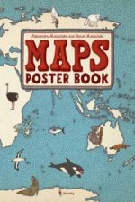
Maps Poster Book
61.11 zł -23 % -
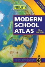
Philip's Modern School Atlas
84.97 zł -
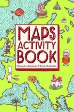
Maps Activity Book
47.31 zł -23 % -

Children's Picture Atlas
47.31 zł -23 % -
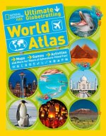
National Geographic Kids Ultimate Globetrotting World Atlas
66.44 zł -10 % -

Oxford School Atlas
56.48 zł -23 % -

Travel Book
133.70 zł -

Oxford Student Atlas
74.80 zł -23 % -

Oxford School Atlas
61.11 zł -23 % -

Children's Wall Map of the United Kingdom and Ireland
28.99 zł -23 % -

Oxford Very First Atlas
33.62 zł -23 % -

Usborne Illustrated Atlas of Britain and Ireland
70.37 zł -23 % -
National Geographic Kids World Atlas
84.06 zł -23 % -

Oxford Student Atlas 2012
74.80 zł -23 % -
Maps Special Edition
188.88 zł -

Barefoot Books World Atlas
70.37 zł -23 % -

Oxford International First Atlas Activity Book
33.92 zł -

Children's Illustrated World Atlas
70.37 zł -23 % -

National Geographic Kids Beginner's World Atlas, 3rd Edition
56.78 zł -
C48 First Atlas Book
55.07 zł -37 % -

Atlas of the World Picture Book
56.78 zł -
Washington DC Children's Map
22.14 zł -13 % -

Guy Fox Maps for Children
22.14 zł -13 % -

First Animal Picture Atlas
61.11 zł -23 % -
Map of Europe
93.02 zł -15 % -

My Pop-up World Atlas
83.56 zł -

Our World
63.52 zł -
First Atlas
81.65 zł -

Atlas of Ocean Adventures
93.12 zł -23 % -
Lonely Planet Kids My Family Travel Map - Europe
90.91 zł -

Oxford Primary Atlas
51.84 zł -23 % -

Oxford First Atlas
47.31 zł -23 % -
National Geographic Kids U.S. Atlas 2020
85.57 zł -5 % -
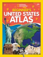
Beginner's U.S. Atlas 2020
61.11 zł -23 % -
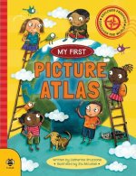
Picture Atlas
28.99 zł -23 % -
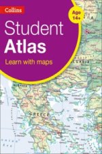
Collins Student Atlas
90.20 zł -

Lonely Planet Kids Amazing World Atlas
70.37 zł -23 % -

Illustrated Atlas of India
98.66 zł -

Children's World Atlas
81.65 zł -

The Kingfisher Atlas of World History
110.34 zł -

National Geographic Little Kids First Big Book of the World
145.98 zł -

First Picture Atlas
51.94 zł -
Mapping Skills
91.31 zł -
Mapping Skills
91.31 zł -
Children's Illustrated Atlas (Library Edition)
87.99 zł
zadowolonych klientów
Od roku 2008 obsłużyliśmy wielu miłośników książek, ale dla nas każdy był tym wyjątkowym.
Copyright! ©2008-24 libristo.pl Wszelkie prawa zastrzeżonePrywatnieCookies


 21 milionów książek
 Dostawa 10.99 zł
 (32) 444 93 66 (8-15.30h)