Kod: 02878069
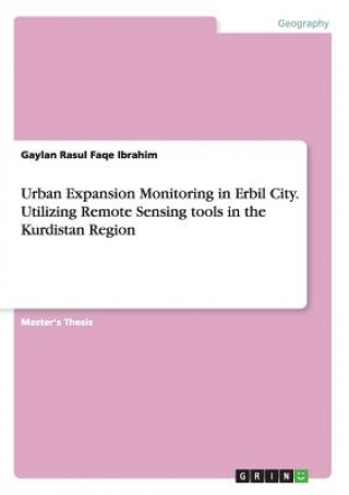
Urban Expansion Monitoring in Erbil City. Utilizing Remote Sensing tools in the Kurdistan Region
Autor Gaylan Rasul Faqe Ibrahim
Master's Thesis from the year 2013 in the subject Geography / Earth Science - Cartography, Geographic Information Science and Geodesy, Sheffield Hallam University (Sheffield Hallam University), language: English, abstract: Monitor ... więcej
- Język:
 Angielski
 - Oprawa: Miękka
- Liczba stron: 74
Wydawca: Grin Publishing, 2015
- Więcej informacji o książce

Zobacz książki o podobnej tematyce
-

Disabled Veterans' Employment
89.88 zł -

Case of Charles Dexter Ward
95.23 zł -

Language and Logic of the Bible
212.12 zł -

Suffer and Be Still
327.70 zł -

Starshine
83.99 zł
Podaruj tę książkę jeszcze dziś
- Zamów książkę i wybierz "Wyślij jako prezent".
- Natychmiast wyślemy Ci bon podarunkowy, który możesz przekazać adresatowi prezentu.
- Książka zostanie wysłana do adresata, a Ty o nic nie musisz się martwić.
Więcej informacji o Urban Expansion Monitoring in Erbil City. Utilizing Remote Sensing tools in the Kurdistan Region
Za ten zakup dostaniesz 149 punkty
 Opis
Opis
Master's Thesis from the year 2013 in the subject Geography / Earth Science - Cartography, Geographic Information Science and Geodesy, Sheffield Hallam University (Sheffield Hallam University), language: English, abstract: Monitoring urban land use/cover changes provide spatio-temporal information on the pattern and the amount of the changes that has taken place across the land use/cover classes, and the information obtained from the urban expansion are valuable for sustainable planning and management of urban resources.§§Remote sensing techniques provide fast and effective means for classifying and mapping urban land cove/use change through examining spectra characteristics of multi-dates satellite images. In recent years, Kurdistan region cities have witnessed a rapid growth of the urban rates due to previous socio-economic and political variations in the area. The purpose of the study is to analyse and visualize spatial pattern of urban land use changes in Erbil city-Kurdistan and to quantify the amount of variations in the land use classes by applying remote sensing approach.§§The research examines multi-dates Landsat 5 TM imageries for 1987, 2000 and 2011 by using supervised classification of maximum Likelihood classifier to display and measure the changes in the land use/classes in ERDAS 9.1 imagine processing software. The accuracy of the overall classification was measured by using confusion metrics and Kappa coefficient to test overall accuracy classification. The study achieved an overall accuracy which rate from 95, 96.43 and 94.29 in 1987, 2000 and 2011 respectively, which indicates that the research has achieved a significant level of classes.§§The outcome of the study revealed that the study area has remarkably experienced changes in its land use/cover during the period of the study as built up area was increased by (3975.66 to 6123.7 hectares) over in 1987 to 2000, and (6123.7 to 12755.1 hectares) in 2000 to 2011. On the other hand, the amount of other classes has greatly declined during the period of the study from. Evidence from the post classification analysis has shown that open land and vegetation classes have experienced the most significant changes of rates in the urban land during the period of the research. For example, the rate of changes from open land to urban land is (5084.46), whereas the rate of the vegetation that converted to urban land is (2130.69).
 Szczegóły książki
Kategoria Książki po angielsku Earth sciences, geography, environment, planning Earth sciences
256.75 zł
- Pełny tytuł: Urban Expansion Monitoring in Erbil City. Utilizing Remote Sensing tools in the Kurdistan Region
- Autor: Gaylan Rasul Faqe Ibrahim
- Język:
 Angielski
 - Oprawa: Miękka
- Liczba stron: 74
- EAN: 9783668104433
- ISBN: 3668104433
- ID: 02878069
- Wydawca: Grin Publishing
- Waga: 109 g
- Wymiary: 210 × 148 × 5 mm
- Data wydania: 09. December 2015
Ulubione w innej kategorii
-

Cowen's History of Life 6e
464.33 zł -

Nature of Nature
111.62 zł -10 % -

Science of the Earth
136.42 zł -14 % -

Information
83.49 zł -12 % -

Earth System History
454.11 zł -
Mesoscale Meteorology in Midlatitudes
397.74 zł -2 % -

Terraforming Mars
1125.42 zł -

ISE Physical Geology
328.91 zł -

Geotechnical Instrumentation and Applications
520.30 zł -

Geoscience for Petroleum Engineers
527.79 zł -

Cold breath of sleeping volcanoes
121.74 zł -4 % -

Introduction to Paleobiology and the Fossil Record , 2nd Edition
310.29 zł -3 % -

Mastering ArchiMate - Edition II
378.10 zł -

Quaternary Dating Methods
498.44 zł -

Earth System Science: A Very Short Introduction
43.10 zł -23 % -

Nature Illuminated
73.77 zł -5 % -

Ecology and Management of Forest Soils 5e
601.36 zł -

Earth History and Palaeogeography
479.10 zł -

Geochemistry, Second Edition
607.44 zł -

Computational Fairy Tales
61.22 zł -

Fundamental Planetary Science
362.31 zł -

Bohdalec
269.20 zł -

New Trends in Earth-Science Outreach and Engagement
571.41 zł -

Hunterian Lectures in Comparative Anatomy, May & June 1837 (Cloth)
458.26 zł -

Quaternary Dating Methods
493.27 zł -

TOGAF Version 9
593.27 zł -

Mineralogy of Quartz and Silica Minerals
298.21 zł -
Climatic Change at High Elevation Sites
878.57 zł -

Sailing Directory for the Baltic, Comprising a General Description of the Bays, Harbours, Islands, Included Between the Sound and the Gulf of Finland.
94.30 zł -

Mutual Evolution of Earth and Humanity
231.96 zł -23 % -

Language of the Earth 2e
251.79 zł -

Python Recipes for Earth Sciences
387.21 zł -

Art of Business Process Modeling
52.92 zł -

Handbook of Archaeological Sciences
754.09 zł -

Blue Planet - An Introduction to Earth System Science 3e
977.96 zł -

Earth Science, Global Edition
503.09 zł -

Geology and Mineralogy of Gemstones
599.54 zł -

Crystallography
443.58 zł -8 % -

Geological and Mud Logging in Drilling Control
289.95 zł -

Red Sea
531.23 zł -9 % -

In Six Days
73.97 zł -5 % -

Lop Nor China
563.31 zł -

Viticulture and Winemaking under Climate Change
298.21 zł -
![Crystallography for Beginners. with an Appendix on the Use of the Blowpipe and the Determination of Common Minerals, Etc. [With 3 Tables of Diagrams.] Crystallography for Beginners. with an Appendix on the Use of the Blowpipe and the Determination of Common Minerals, Etc. [With 3 Tables of Diagrams.]](https://media.libris.to/jacket/07986811t.jpg)
Crystallography for Beginners. with an Appendix on the Use of the Blowpipe and the Determination of Common Minerals, Etc. [With 3 Tables of Diagrams.]
97.28 zł -5 % -

Oceans For Dummies
107.78 zł -10 % -

Principles of Engineering Management
1134.52 zł -

Synthetic Aperture Radar (SAR) Techniques and Applications
332.34 zł -

Conservation of Architectural Heritage
1134.52 zł -

Metallurgy of Steel. ... Second Edition ... Enlarged. Vol. 1.
178.71 zł
zadowolonych klientów
Od roku 2008 obsłużyliśmy wielu miłośników książek, ale dla nas każdy był tym wyjątkowym.
Copyright! ©2008-24 libristo.pl Wszelkie prawa zastrzeżonePrywatnieCookies


 21 milionów książek
 Dostawa 10.99 zł
 (32) 444 93 66 (8-15.30h)