Code: 15995844
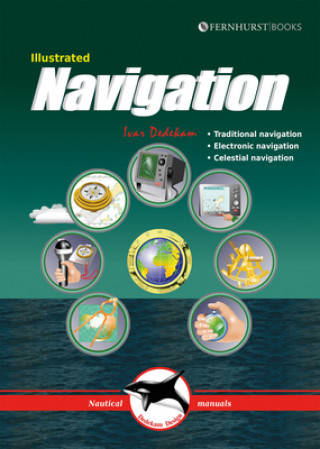
Illustrated Navigation
by Ivar Dedekam
GPS and chart plotters have made navigation simple, but still require understanding and back-up. This book shows how to navigate traditionally (compass, log & plotter); using electronic aids (GPS, radar & chart plotter); and using ... more
- Language:
 English
 - Binding: Paperback
- Number of pages: 84
Publisher: Fernhurst Books Limited, 2017
- More about this

104.54 zł
RRP: 112.45 zł
You save 7.91 zł

Low in stock at our supplier
Shipping in 10 - 14 days
Potřebujete více kusů?Máte-li zájem o více kusů, prověřte, prosím, nejprve dostupnost titulu na naši zákaznické podpoře.
Add to wishlist
You might also like
-

Berserk Deluxe Volume 2
213.64 zł -1 % -

Can't Hurt Me
133.18 zł -

Oxford Discover: Level 1: Workbook with Online Practice
52.21 zł -2 % -

Prepper's Long-term Survival Guide
66.18 zł -11 % -

The American Roommate Experiment
43.61 zł -15 % -

Woodpecker Method
132.07 zł -7 % -

21st Century Boys: The Perfect Edition, Vol. 1
90.57 zł -13 % -

The Brain That Changes Itself
52.62 zł -15 % -

Lippincott Illustrated Reviews: Pharmacology
223.35 zł -

Birthday Stories
47.25 zł -14 % -

Illustrated Seamanship
66.18 zł -23 % -

Greek Tragedy
70.23 zł -10 % -

Linux Bible, Tenth Edition
243.49 zł -10 % -

Kitty Kotty in the Playground
8.49 zł -19 % -

Through the Language Glass
52.62 zł -15 % -

Mismatch
72.05 zł -13 % -

ALLOY OF LAW
46.55 zł -12 % -

Illustrated Sail & Rig Tuning
70.73 zł -23 % -

Celestial Navigation
56.87 zł -23 % -

Cherish
87.13 zł -12 % -

Daughter of the Pirate King
56.77 zł -7 %
Give this book as a present today
- Order book and choose Gift Order.
- We will send you book gift voucher at once. You can give it out to anyone.
- Book will be send to donee, nothing more to care about.
More about Illustrated Navigation
You get 61 loyalty points
 Book synopsis
GPS and chart plotters have made navigation simple, but still require understanding and back-up. This book shows how to navigate traditionally (compass, log & plotter); using electronic aids (GPS, radar & chart plotter); and using the sun & stars (celestial navigation). It is heavily illustrated making it easy to understand and follow.
 Book details
Book category Books in English Technology, engineering, agriculture Transport technology & trades Shipbuilding technology, engineering & trades
104.54 zł
- Full title: Illustrated Navigation
- Subtitle: Traditional, Electronic & Celestial Navigation
- Author: Ivar Dedekam
- Language:
 English
 - Binding: Paperback
- Number of pages: 84
- EAN: 9781909911581
- ISBN: 1909911585
- ID: 15995844
- Publisher: Fernhurst Books Limited
- Weight: 246 g
- Dimensions: 172 × 240 × 7 mm
- Date of publishing: 04. April 2017
Trending among others
-

Rigging: Period Fore-And-Aft Craft
70.73 zł -23 % -

RYA VHF Handbook
91.08 zł -14 % -

Skipper's Pocketbook
69.82 zł -16 % -

Annapolis Book of Seamanship
213.13 zł -11 % -

How To Read Water
52.62 zł -15 % -

Lighthouses of Europe
94.72 zł -19 % -

Marine Diesel Engines
123.67 zł -7 % -

Long Term Almanac 2000-2050 for the Sun and Selected Stars
159.19 zł -6 % -

Elements of Boat Strength: For Builders, Designers, and Owners
130.75 zł -23 % -

Ship Model Building
55.05 zł -10 % -

Warship 2019
276.79 zł -

History of Marine Architecture
351.48 zł -

German submarine U-1105 'Black Panther'
137.94 zł -11 % -

USS Saratoga (CV-3)
156.56 zł -11 % -

Building Strip-Planked Boats
89.15 zł -23 % -

Elements of Yacht Design
109.50 zł -

Boatbuilding
280.94 zł -7 % -

Emergency Navigation
89.15 zł -7 % -

Reeds Crew Handbook
58.99 zł -4 % -

Rigging
117.29 zł -

Ultrasimple Boat Building
137.13 zł -3 % -

Designing Power & Sail
121.44 zł -4 % -

Nelson's Navy
185.91 zł -23 % -

Mediterranean Weather Handbook for Sailors
67.90 zł -14 % -

Building Outrigger Sailing Canoes
129.03 zł -2 % -

East Aegean
267.89 zł -

Encyclopedia of Yacht Designers
972.69 zł -5 % -

Navigator's Log Book
55.55 zł -15 % -

Building a Fiberglass Boat
106.06 zł -4 % -

Understanding Boat Design
104.33 zł -3 % -

IALA Buoyage
19.83 zł -

German U-Boat Type XXI
62.64 zł -10 % -

British Town Class Cruisers
185.91 zł -23 % -

Yachtmaster Exercises for Sail and Power
144.72 zł -4 % -

History of Marine Architecture
351.48 zł -

RYA - An Introduction to Navigation
83.49 zł -14 % -

Barefoot Navigator
98.97 zł -4 % -

Instant Handbook of Boat Handling, Navigation, and Seamanship
198.66 zł -3 % -

Ship Construction
326.48 zł -

Logbook for GPS Navigation
103.32 zł -

RYA Introduction to Radar
52.72 zł -15 % -

Catamarans
294.91 zł -

U.S. Army Map Reading and Land Navigation Handbook - Illustrated (U.S. Army)
86.02 zł -5 % -

Formulas for the E6-B Air Navigation Computer
71.75 zł -

Ships & Shipbuilding
908.63 zł -22 % -

Pocket Book of the International Regulations for Preventing Collisions at Sea
22.05 zł -5 % -

Marine Navigation 1 : Piloting
289.95 zł -

Marine Propellers and Propulsion
788.70 zł -5 % -

Reeds Weather Handbook 2nd edition
70.53 zł -4 %
safisfied customers
Since 2008, we have served long line of book lovers, but each of them was always on the first place.
Copyright! ©2008-24 libristo.pl All rights reservedPrivacyPoučení o cookies


 21 million books
 Delivery 12.99 zł
 (32) 444 93 66 (8-15.30h)