Kod: 05280962
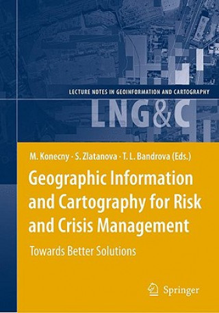
Geographic Information and Cartography for Risk and Crisis Management
Autor Milan Konecny, Sisi Zlatanova, Temenoujka L. Bandrova
Cartography and geographic information (GI) are remarkably appropriate for the requirements of early warning (EW) and crisis management (CM). The use of geospatial technology has increased tremendously in the last years. ICT has c ... więcej
- Język:
 Angielski
 - Oprawa: Twarda
- Liczba stron: 429
Wydawca: Springer-Verlag Berlin and Heidelberg GmbH & Co. KG, 2010
- Więcej informacji o książce

874.50 zł

Dostępna u dostawcy w małych ilościach
Wysyłamy za 12 - 15 dni
Potrzebujesz więcej egzemplarzy?Jeżeli jesteś zainteresowany zakupem większej ilości egzemplarzy, skontaktuj się z nami, aby sprawdzić ich dostępność.
Dodaj do schowka
Zobacz książki o podobnej tematyce
-

Science Fiction Gems, Volume Six, Edmond Hamilton and Others
64.06 zł -

Penetration Testing Fundamentals
429.84 zł -

A Christmas Carol: in Prose, Being a Ghost-Story of Christmas
33.10 zł -

Principles and Practice of Constraint Programming - CP98
568.76 zł -

Croce, Gramsci, Bobbio and the Italian Political Tradition
258.38 zł -

Master Key System
103.65 zł -

A Long and Happy Life
69.90 zł -10 %
Bon podarunkowy: Radość gwarantowana
- Podaruj bon o dowolnej wartości, a my się zajmiemy resztą.
- Bon podarunkowy dotyczy całej naszej oferty.
- Możesz wydrukować elektroniczny bon z e-maila a następnie przekazać go obdarowanemu.
- Ważność bonu wynosi 12 miesięcy od daty wystawienia.
Więcej informacji o Geographic Information and Cartography for Risk and Crisis Management
Za ten zakup dostaniesz 509 punkty
 Opis
Opis
Cartography and geographic information (GI) are remarkably appropriate for the requirements of early warning (EW) and crisis management (CM). The use of geospatial technology has increased tremendously in the last years. ICT has changed from just using maps created in advance, to new approaches, allowing individuals (decision-makers) to use cartography interactively, on the basis of individual user's requirements. The new generation of cartographic visualizations based on standardisation, formal modelling, use of sensors, semantics and ontology, allows for the better adaptation of information to the needs of the users. In order to design a new framework in pre-disaster and disaster management safety/security/privacy aspects of institutions and citizens need to be considered. All this can only be achieved by demonstrating new research achievements, sharing best practices (e.g. in the health area) and working towards the wider acceptance of geospatial technology in society, with the help of education and media.§This book will outline research frontiers and applications of cartography and GI in EW and CM and document their roles and potentials in wider processes going on in information/knowledge-based societies.
 Szczegóły książki
Kategoria Książki po angielsku Earth sciences, geography, environment, planning Geography Geographical information systems (GIS) & remote sensing
874.50 zł
- Pełny tytuł: Geographic Information and Cartography for Risk and Crisis Management
- Podtytuł: Towards Better Solutions
- Autor: Milan Konecny, Sisi Zlatanova, Temenoujka L. Bandrova
- Język:
 Angielski
 - Oprawa: Twarda
- Liczba stron: 429
- EAN: 9783642034411
- ISBN: 3642034411
- ID: 05280962
- Wydawca: Springer-Verlag Berlin and Heidelberg GmbH & Co. KG
- Waga: 863 g
- Wymiary: 235 × 155 × 30 mm
- Data wydania: 31. January 2010
Ulubione w innej kategorii
-

Designing Better Maps
293.54 zł -5 % -

Cartography.
285.68 zł -5 % -

Mastering Geospatial Analysis with Python
263.12 zł -

Semiology of Graphics
587.60 zł -

Geographic Information Science and Systems 4e
1055.63 zł -
GIS for Science
197.44 zł -5 % -

Geocaching
82.60 zł -4 % -

Introduction to Geographical Information Systems, An
360.63 zł -

Connections and Content
221.92 zł -

Focus on Geodatabases in ArcGIS Pro
293.74 zł -4 % -

Framework for Geodesign
389.85 zł -4 % -
Esri Guide to GIS Analysis, Volume 3
221.61 zł -5 % -

Springer Handbook of Geographic Information
1780.94 zł -

Reconstruction and Analysis of 3D Scenes
831.79 zł -

Geoinformatics
155.83 zł -

Mastering ArcGIS Server Development with JavaScript
235.21 zł -

LiDAR Remote Sensing and Applications
521.71 zł -

GIS For Dummies
169.63 zł -

ArcGIS Book
101.63 zł -4 % -

Python For ArcGIS
619.93 zł -

Spring Boot Messaging
237.63 zł -

GNSS - Global Navigation Satellite Systems
919.33 zł -

GIS in Land and Property Management
1077.28 zł -

Spatial Statistics and Geostatistics
358.12 zł -

Programming GPS and OpenStreetMap Applications with Java
360.33 zł -

European Landscape Dynamics
1017.55 zł -

Introduction to GIS Programming and Fundamentals with Python and ArcGIS (R)
615.30 zł -

Satellite Interferometry Data Interpretation and Exploitation
743.84 zł -9 % -

Error Propagation in Environmental Modelling with GIS
666.07 zł -

QGIS Python Programming Cookbook -
263.02 zł -

Learning ArcGIS Pro
263.02 zł -

GPS For Dummies 2e
113.62 zł -5 % -

Mastering QGIS -
291.02 zł -

Introducing Geographic Information Systems with ArcGIS - A Workbook Approach to Learning GIS, Third Edition
563.72 zł -

Integration of GIS and Remote Sensing
1157.98 zł -

Energy of Nations
224.84 zł -

Physical Principles of Remote Sensing
834 zł -

New Developments and Environmental Applications of Drones
925.47 zł -

Mapping with ArcGIS Pro
235.21 zł -

GIS and Spatial Analysis for the Social Sciences
497.84 zł -

Satellite Altimetry Over Oceans and Land Surfaces
1077.28 zł -

Learning QGIS 2.0
132.56 zł -

ArcGIS Pro and ArcGIS Online Applications in Water and Environmental Sciences
407.38 zł -

Open Source GIS
874.50 zł -

Recent Advances in Remote Sensing for Crop Growth Monitoring
435.48 zł -1 % -

Spatial Conservation Prioritization
963.95 zł -

Artificial Intelligence in Geography
1540.28 zł -

Geolocation in iOS
104.15 zł -

Remote Sensing Data Book
597.97 zł
zadowolonych klientów
Od roku 2008 obsłużyliśmy wielu miłośników książek, ale dla nas każdy był tym wyjątkowym.
Copyright! ©2008-24 libristo.pl Wszelkie prawa zastrzeżonePrywatnieCookies


 21 milionów książek
 Dostawa 10.99 zł
 (32) 444 93 66 (8-15.30h)