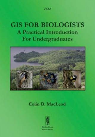
Kod: 02985430
GIS for Biologists: A Practical Introduction for Undergraduates
Autor Colin MacLeod
This book provides a user-friendly and practical introduction for undergraduates to the use of Geographic Information Systems (GIS) in biological research. Unlike most other books about using GIS, this information is specifically ... więcej
- Język:
 Angielski
 - Oprawa: Miękka
- Liczba stron: 352
Wydawca: Pictish Beast Publications, 2015
- Więcej informacji o książce

Zobacz książki o podobnej tematyce
-

New Religious Movements and Religious Liberty in America
227.96 zł -

Oxford Movement in Practice
807.70 zł -

Corporate Governance
242.27 zł -

Book of the Love of Jesus
113.22 zł
Podaruj tę książkę jeszcze dziś
- Zamów książkę i wybierz "Wyślij jako prezent".
- Natychmiast wyślemy Ci bon podarunkowy, który możesz przekazać adresatowi prezentu.
- Książka zostanie wysłana do adresata, a Ty o nic nie musisz się martwić.
Więcej informacji o GIS for Biologists: A Practical Introduction for Undergraduates
Za ten zakup dostaniesz 122 punkty
 Opis
Opis
This book provides a user-friendly and practical introduction for undergraduates to the use of Geographic Information Systems (GIS) in biological research. Unlike most other books about using GIS, this information is specifically presented in a biological context and it is divided into two sections. The first section provides just enough background information to allow the novice biological GIS user to get started with GIS without getting too bogged down in the theory behind it or making some of the most common mistakes made by beginners. It covers areas such as what GIS is, why GIS is useful in biology, the basics of GIS, common concepts and terms in GIS, how data are contained in a GIS, useful information about what to think about before starting a GIS project and how to break down and translate ecological tasks into the language of GIS. This information is all provided in easy-to-read and non-technical language, with specific reference to its application in biological research. The second section, which constitutes the main body of the book, consists of six practical exercises accompanied by detailed instruction sets. The first four exercises introduce the novice biological GIS user to basic, but important, GIS skills, such as making a map, creating new feature data layers, creating raster data layers and joining together data from different data layers. The final two consist of case studies of how GIS can be used to answer real biological research questions. Each of these exercises represents a stand-alone GIS lesson which can be completed either on its own or as part of a practical session for an undergraduate class. In addition, each exercise focuses on a different area of biology, such as tropical ornithology, epidemiology, marine biology and rainforest ecology, and on a different part of the world, including the Amazon rainforest, a Scottish field station, Mount Mabu in northern Mozambique, the North Atlantic Ocean and the USA. Instructions for each exercise are provided for both the leading commercial GIS package (ESRI's ArcGIS® 10.3 software) and the leading freely available open-source GIS software (QGIS 2.8.3, also known as Quantum GIS), meaning that this book can be used to learn, or teach, how to use of GIS in biological research, regardless of the availability of commercial software licences. Taken together, the two sections of this book provide the perfect primer to show undergraduates, and other novice GIS users, how useful GIS can be in biological research, why it is rapidly becoming a key skill in many areas of biology, and how start in using it. The PSLS series of books uses Task-Oriented Learning (TOL) to teach the practical application of research skills to the life sciences. This involves demonstrating how these skills can be used in the specific circumstances in which they are likely to be required, rather than concentrating on teaching theoretical frameworks or on teaching skills in a generic or abstract manner. By seeing how the similar processes are used to achieve a variety of different goals within a specific field, it becomes easier for the reader to identify the general rules behind the practical application of these processes and, therefore, to transfer them to novel situations they may encounter in the future.
 Szczegóły książki
Kategoria Książki po angielsku Earth sciences, geography, environment, planning Geography Geographical information systems (GIS) & remote sensing
210.11 zł
- Pełny tytuł: GIS for Biologists: A Practical Introduction for Undergraduates
- Autor: Colin MacLeod
- Język:
 Angielski
 - Oprawa: Miękka
- Liczba stron: 352
- EAN: 9781909832176
- ISBN: 1909832170
- ID: 02985430
- Wydawca: Pictish Beast Publications
- Waga: 632 g
- Wymiary: 173 × 338 × 20 mm
- Data wydania: 30. December 2015
Ulubione w innej kategorii
-
Designing Better Maps
293.79 zł -5 % -

Cartography.
285.93 zł -5 % -
Mastering Geospatial Analysis with Python
263.34 zł -

Semiology of Graphics
577.51 zł -

Geographic Information Science and Systems 4e
1056.53 zł -
GIS for Science
197.61 zł -5 % -
Geocaching
82.67 zł -4 % -

Introduction to Geographical Information Systems, An
360.94 zł -

Connections and Content
222.11 zł -
Focus on Geodatabases in ArcGIS Pro
293.99 zł -4 % -
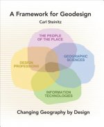
Framework for Geodesign
390.18 zł -4 % -
Esri Guide to GIS Analysis, Volume 3
221.80 zł -5 % -

Springer Handbook of Geographic Information
1643.94 zł -

Reconstruction and Analysis of 3D Scenes
832.50 zł -
Geoinformatics
155.97 zł -
Mastering ArcGIS Server Development with JavaScript
235.42 zł -

LiDAR Remote Sensing and Applications
522.16 zł -
GIS For Dummies
169.78 zł -
ArcGIS Book
101.72 zł -4 % -
Python For ArcGIS
615.83 zł -

Spring Boot Messaging
237.84 zł -
GNSS - Global Navigation Satellite Systems
920.12 zł -

GIS in Land and Property Management
1078.21 zł -
Spatial Statistics and Geostatistics
358.42 zł -
Programming GPS and OpenStreetMap Applications with Java
360.64 zł -
European Landscape Dynamics
1018.42 zł -
Introduction to GIS Programming and Fundamentals with Python and ArcGIS (R)
615.83 zł -
Satellite Interferometry Data Interpretation and Exploitation
744.48 zł -9 % -
Error Propagation in Environmental Modelling with GIS
666.64 zł -

QGIS Python Programming Cookbook -
263.24 zł -
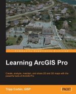
Learning ArcGIS Pro
263.24 zł -
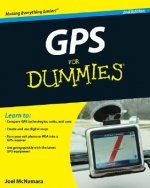
GPS For Dummies 2e
113.72 zł -5 % -
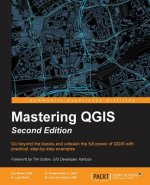
Mastering QGIS -
291.27 zł -
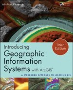
Introducing Geographic Information Systems with ArcGIS - A Workbook Approach to Learning GIS, Third Edition
516.11 zł -
Integration of GIS and Remote Sensing
1158.97 zł -

Energy of Nations
225.03 zł -
Physical Principles of Remote Sensing
834.72 zł -
New Developments and Environmental Applications of Drones
955.51 zł -
Mapping with ArcGIS Pro
235.42 zł -

GIS and Spatial Analysis for the Social Sciences
498.27 zł -

Satellite Altimetry Over Oceans and Land Surfaces
1078.21 zł -
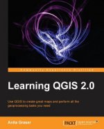
Learning QGIS 2.0
132.68 zł -
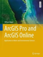
ArcGIS Pro and ArcGIS Online Applications in Water and Environmental Sciences
407.73 zł -
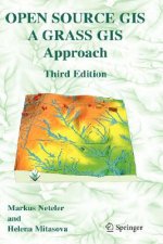
Open Source GIS
875.25 zł -
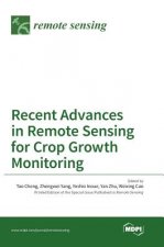
Recent Advances in Remote Sensing for Crop Growth Monitoring
435.85 zł -1 % -
Spatial Conservation Prioritization
964.78 zł -

Artificial Intelligence in Geography
1541.60 zł -
Geolocation in iOS
104.24 zł -
Remote Sensing Data Book
598.49 zł
zadowolonych klientów
Od roku 2008 obsłużyliśmy wielu miłośników książek, ale dla nas każdy był tym wyjątkowym.
Copyright! ©2008-24 libristo.pl Wszelkie prawa zastrzeżonePrywatnieCookies


 21 milionów książek
 Dostawa 10.99 zł
 (32) 444 93 66 (8-15.30h)