
Kod: 01963764
Progress in Geospatial Analysis
Autor Yuji Murayama
This book examines the current development trends on methods and application of geospatial analysis and highlights future development prospects. It aims to provide a comprehensive discussion that includes Remote Sensing and GIS ba ... więcej
- Język:
 Angielski
 - Oprawa: Twarda
- Liczba stron: 292
Wydawca: Springer Verlag, Japan, 2012
- Więcej informacji o książce

573.28 zł

Dostępna u dostawcy w małych ilościach
Wysyłamy za 12 - 15 dni
Potrzebujesz więcej egzemplarzy?Jeżeli jesteś zainteresowany zakupem większej ilości egzemplarzy, skontaktuj się z nami, aby sprawdzić ich dostępność.
Dodaj do schowka
Zobacz książki o podobnej tematyce
Podaruj tę książkę jeszcze dziś
- Zamów książkę i wybierz "Wyślij jako prezent".
- Natychmiast wyślemy Ci bon podarunkowy, który możesz przekazać adresatowi prezentu.
- Książka zostanie wysłana do adresata, a Ty o nic nie musisz się martwić.
Więcej informacji o Progress in Geospatial Analysis
Za ten zakup dostaniesz 331 punkty
 Opis
Opis
This book examines the current development trends on methods and application of geospatial analysis and highlights future development prospects. It aims to provide a comprehensive discussion that includes Remote Sensing and GIS based data processing techniques, current practices on theories, models, and applications of geospatial analysis in geography. This book is written for academics, researchers, practitioners, and advanced graduate students. It will be designed to be read by those new or starting out in the field of geospatial analysis as well as by those who are already familiar with the field. The chapters have been selected from the experienced authors in such a way that readers who are new to the field will gain important overview and insight. At the same time, those readers who are already practitioners in the field will gain through the advanced and updated materials and state-of-the-art developments in the geospatial analysis. Data acquisition and processing techniques such as remote sensing image selections, classifications, accuracy assessments, models of GIS data model and spatial modeling process will be highlighted in the first part. In the second part, theories and methods including GIS network model, artificial neural network, Markov-CA, fuzzy sets, weight of evidence, spatial autocorrelations, geographically weighted regression, multi-criteria GIS analysis models, agent based models, and spatial visualization will be included. Part three will present selected best practices on geospatial analysis.
 Szczegóły książki
Kategoria Książki po angielsku Earth sciences, geography, environment, planning Geography Geographical information systems (GIS) & remote sensing
573.28 zł
- Pełny tytuł: Progress in Geospatial Analysis
- Autor: Yuji Murayama
- Język:
 Angielski
 - Oprawa: Twarda
- Liczba stron: 292
- EAN: 9784431539995
- ISBN: 4431539999
- ID: 01963764
- Wydawca: Springer Verlag, Japan
- Waga: 627 g
- Wymiary: 235 × 155 × 21 mm
- Data wydania: 07. July 2012
Ulubione w innej kategorii
-
Designing Better Maps
314.05 zł -4 % -

Cartography.
305.63 zł -4 % -
Mastering Geospatial Analysis with Python
270.59 zł -

Semiology of Graphics
592.27 zł -

Geographic Information Science and Systems 4e
1064.54 zł -
GIS for Science
215.96 zł -

Geocaching
82.85 zł -8 % -

Introduction to Geographical Information Systems, An
336.59 zł -

Connections and Content
211.09 zł -4 % -

Focus on Geodatabases in ArcGIS Pro
268.06 zł -14 % -

Framework for Geodesign
417.02 zł -4 % -
Esri Guide to GIS Analysis, Volume 3
250.39 zł -

Springer Handbook of Geographic Information
1834.72 zł -

Reconstruction and Analysis of 3D Scenes
799.82 zł -2 % -

Geoinformatics
160.22 zł -

Mastering ArcGIS Server Development with JavaScript
241.86 zł -

LiDAR Remote Sensing and Applications
525.87 zł -

GIS For Dummies
171.69 zł -

ArcGIS Book
110.36 zł -4 % -

Python For ArcGIS
624.87 zł -

Spring Boot Messaging
239.52 zł -
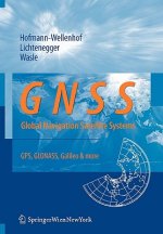
GNSS - Global Navigation Satellite Systems
1035.60 zł -

GIS in Land and Property Management
1364.79 zł -

Spatial Statistics and Geostatistics
369.39 zł -

Programming GPS and OpenStreetMap Applications with Java
363.40 zł -

European Landscape Dynamics
1055.90 zł -

Satellite Interferometry Data Interpretation and Exploitation
749.76 zł -9 % -

Introduction to GIS Programming and Fundamentals with Python and ArcGIS (R)
634.01 zł -
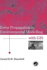
Error Propagation in Environmental Modelling with GIS
686.30 zł -

QGIS Python Programming Cookbook -
270.59 zł -

Learning ArcGIS Pro
270.59 zł -

GPS For Dummies 2e
109.65 zł -9 % -

Introducing Geographic Information Systems with ArcGIS - A Workbook Approach to Learning GIS, Third Edition
568.21 zł -

Mastering QGIS -
299.33 zł -
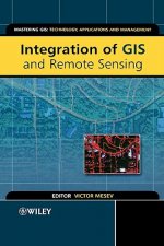
Integration of GIS and Remote Sensing
1191.16 zł -

Energy of Nations
231.70 zł -

Physical Principles of Remote Sensing
903.80 zł -

New Developments and Environmental Applications of Drones
932.84 zł -

GIS and Spatial Analysis for the Social Sciences
501.80 zł -

Satellite Altimetry Over Oceans and Land Surfaces
1208.32 zł -

Mapping with ArcGIS Pro
241.86 zł -

Learning QGIS 2.0
136.36 zł -

Open Source GIS
881.46 zł -
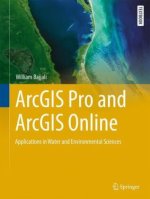
ArcGIS Pro and ArcGIS Online Applications in Water and Environmental Sciences
410.42 zł -
Geographic Information Systems (GIS)
1345.60 zł -22 % -

Geographical Information Science
423.61 zł -

Spatial Conservation Prioritization
971.93 zł -

Digital Terrain Modelling
881.46 zł -

Thermal Infrared Remote Sensing
927.86 zł
zadowolonych klientów
Od roku 2008 obsłużyliśmy wielu miłośników książek, ale dla nas każdy był tym wyjątkowym.
Copyright! ©2008-24 libristo.pl Wszelkie prawa zastrzeżonePrywatnieCookies


 21 milionów książek
 Dostawa 10.99 zł
 (32) 444 93 66 (8-15.30h)