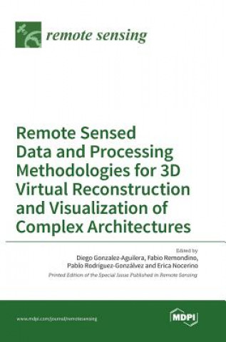
Kod: 14265637
Remote Sensed Data and Processing Methodologies for 3D Virtual Reconstruction and Visualization of Complex Architectures
Remote Sensing | Special Issue : Remote Sensed Data and Processing Methodologies for 3D Virtual Reconstruction and Visualization of Complex Architectures In recent years, th ... więcej
- Język:
 Angielski
 - Oprawa: Twarda
- Liczba stron: 602
Wydawca: Mdpi AG, 2016
- Więcej informacji o książce

643.47 zł
Zwykle: 649.97 zł
Oszczędzasz 6.50 zł

Dostępna u dostawcy
Wysyłamy za 14 - 18 dni
Zobacz książki o podobnej tematyce
-

From Sacred Waters and Pagan Goddesses to Holy Wells: the Cult of Saints and the Virgin Mary in Medieval Britain
72.79 zł -

New Super-Man Vol. 2: Coming to America (Rebirth)
70.37 zł -23 % -

McKinney
128.67 zł -4 % -

Prisoner No. 100 - An Account of My Days and Nights in an Indian Prison
104.70 zł -

Technology for Physical Education Teacher Education
206.96 zł -

BOYS AND MEN: A STORY OF LIFE AT YALE
164.71 zł -

Fiscal Policies in Federal States
467.78 zł
Podaruj tę książkę jeszcze dziś
- Zamów książkę i wybierz "Wyślij jako prezent".
- Natychmiast wyślemy Ci bon podarunkowy, który możesz przekazać adresatowi prezentu.
- Książka zostanie wysłana do adresata, a Ty o nic nie musisz się martwić.
Więcej informacji o Remote Sensed Data and Processing Methodologies for 3D Virtual Reconstruction and Visualization of Complex Architectures
Za ten zakup dostaniesz 375 punkty
 Opis
Opis
Remote Sensing | Special Issue : Remote Sensed Data and Processing Methodologies for 3D Virtual Reconstruction and Visualization of Complex Architectures In recent years, the topic of 3D reconstruction and modeling of complex architectures from remotely acquired multiple data sources has been of growing interest. This "democratization" of 3D modeling processes and the large availability of data is, however, not always followed by reliable, affordable and powerful tools for realizing photo-realistic, metric, re-usable and semantic-aware 3D products. This should be a motivation to research, design, develop and validate novel easy-to-use, ease-to-learn and a low-cost framework for 3D modeling and further understanding of virtual environments using multiple data sources, so that the whole 3D modeling community has access to an affordable, transferable, functional and usable framework of methods and tools. This challenge causes several problems that should be addressed: from improving and testing the technical capabilities of new capturing devices, to the solution of problems resultant from large image blocks, from delivering Building Information Modeling (BIM) standards in order to provide new management approaches to replacing existing visualization tools with new working experiences such as Virtual and Augmented Reality or game-engine technology.
 Szczegóły książki
Kategoria Książki po angielsku Earth sciences, geography, environment, planning Geography Geographical information systems (GIS) & remote sensing
643.47 zł
- Pełny tytuł: Remote Sensed Data and Processing Methodologies for 3D Virtual Reconstruction and Visualization of Complex Architectures
- Język:
 Angielski
 - Oprawa: Twarda
- Liczba stron: 602
- EAN: 9783038422372
- ISBN: 3038422371
- ID: 14265637
- Wydawca: Mdpi AG
- Waga: 1454 g
- Wymiary: 181 × 252 × 50 mm
- Data wydania: 26. August 2016
Ulubione w innej kategorii
-
Designing Better Maps
293.39 zł -5 % -

Cartography.
285.54 zł -5 % -

Mastering Geospatial Analysis with Python
262.98 zł -

Semiology of Graphics
525.37 zł -4 % -

Geographic Information Science and Systems 4e
1054.68 zł -

GIS for Science
197.34 zł -5 % -

Geocaching
82.55 zł -4 % -

Introduction to Geographical Information Systems, An
360.45 zł -

Connections and Content
197.34 zł -5 % -

Focus on Geodatabases in ArcGIS Pro
293.59 zł -4 % -

Framework for Geodesign
389.44 zł -4 % -
Esri Guide to GIS Analysis, Volume 3
221.50 zł -5 % -

Springer Handbook of Geographic Information
1780.02 zł -

Reconstruction and Analysis of 3D Scenes
831.36 zł -

Geoinformatics
155.75 zł -
Mastering ArcGIS Server Development with JavaScript
235.09 zł -

LiDAR Remote Sensing and Applications
521.44 zł -

GIS For Dummies
169.14 zł -

ArcGIS Book
101.58 zł -4 % -

Python For ArcGIS
614.98 zł -

Spring Boot Messaging
244.15 zł -

GNSS - Global Navigation Satellite Systems
918.85 zł -

GIS in Land and Property Management
1076.73 zł -

Spatial Statistics and Geostatistics
357.93 zł -
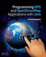
Programming GPS and OpenStreetMap Applications with Java
360.14 zł -

European Landscape Dynamics
1017.02 zł -
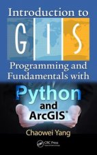
Introduction to GIS Programming and Fundamentals with Python and ArcGIS (R)
614.98 zł -

Satellite Interferometry Data Interpretation and Exploitation
743.46 zł -9 % -

Error Propagation in Environmental Modelling with GIS
665.73 zł -

QGIS Python Programming Cookbook -
262.88 zł -

Learning ArcGIS Pro
262.88 zł -

GPS For Dummies 2e
113.56 zł -5 % -

Mastering QGIS -
290.87 zł -

Introducing Geographic Information Systems with ArcGIS - A Workbook Approach to Learning GIS, Third Edition
574.81 zł -
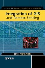
Integration of GIS and Remote Sensing
1157.38 zł -

Energy of Nations
224.72 zł -

Physical Principles of Remote Sensing
833.57 zł -

New Developments and Environmental Applications of Drones
935.67 zł -
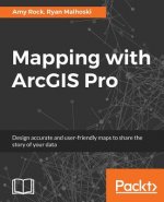
Mapping with ArcGIS Pro
235.09 zł -

GIS and Spatial Analysis for the Social Sciences
497.58 zł -

Satellite Altimetry Over Oceans and Land Surfaces
1076.73 zł -

Learning QGIS 2.0
132.49 zł -

Open Source GIS
868.21 zł -

ArcGIS Pro and ArcGIS Online Applications in Water and Environmental Sciences
407.17 zł -

Recent Advances in Remote Sensing for Crop Growth Monitoring
435.26 zł -1 % -

Spatial Conservation Prioritization
963.46 zł -

Artificial Intelligence in Geography
1539.48 zł -

Geolocation in iOS
104.10 zł -

Spatial Data Mining
463.15 zł
zadowolonych klientów
Od roku 2008 obsłużyliśmy wielu miłośników książek, ale dla nas każdy był tym wyjątkowym.
Copyright! ©2008-24 libristo.pl Wszelkie prawa zastrzeżonePrywatnieCookies


 21 milionów książek
 Dostawa 10.99 zł
 (32) 444 93 66 (8-15.30h)